Kingston, New York
| Kingston | |
|---|---|
| — City — | |
 |
|
 Kingston
|
|
| Coordinates: | |
| Country | United States |
| State | New York |
| County | Ulster |
| Government | |
| - Mayor | James Sottile (D) |
| - Common Council |
Members' List
|
| Elevation | 476 ft (145 m) |
| Population (2000) | |
| - City | 23,456 |
| - Metro | 177,749 |
| Time zone | Eastern (EST) (UTC-5) |
| - Summer (DST) | EDT (UTC-4) |
| ZIP codes | 12401-12402 |
| Area code(s) | 845 |
| FIPS code | 36-39738 |
| GNIS feature ID | 0979119 |
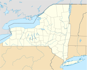
Kingston is a city in Ulster County, New York, United States. It is 91 miles (146 km) north of New York City and 59 miles (90 km) south of Albany along the Hudson River. The population was 23,456 at the 2000 census. Kingston is the core city of the Kingston, New York Metropolitan Statistical Area and is part of the larger New York–Newark–Bridgeport, NY-NJ-CT-PA Combined Statistical Area. The city of Kingston is on the eastern border of Ulster County, and is the county seat.
Contents |
History
| New Netherland series | |
|---|---|
| Exploration | |
| Fortifications: | |
|
|
| Settlements: | |
|
|
| The Patroon System Charter of Freedoms and Exemptions |
|
| Directors of New Netherland: Cornelius Jacobsen May (1620-25) |
|
| People of New Netherland New Netherlander |
|
| Flushing Remonstrance |
|
 |
|
The city of Kingston was first called Esopus after a local Indian tribe, then Wiltwyck. Settled in 1651, it was one of the three large settlements in New Netherland, the other two being Beverwyck, now Albany, and New Amsterdam, now New York City. In 1777, Kingston became the first capital of New York. This is due to the fact that during the summer of 1777, when the state constitution was written, Albany, the historic center of government of New York, was under threat of attack by Burgoyne and his army. The state's founding fathers believed Kingston would be a safer place. Ironically, the British never reached Albany, being stopped at Saratoga, but they did reach Kingston. Shortly after the Battle of Saratoga, the city was burned by British troops moving up the Hudson River from New York City, disembarking at the mouth of the Rondout Creek on the formation the Dutch had named Ponck Hockie.[1] Contrary to popular belief there wasn't a large conflict between the townsfolk and the British invaders. This is because the denizens of Kingston knew of the oncoming fleet. The city had been evacuated by the time the British arrived, and the settlers had moved to Hurley, New York, which the British did not attack.
The area was a major granary for the colonies at the time, so the British burned large amounts of wheat and all but one or two of the buildings. There is some debate over exactly how much of a fight was put up against the British; one third of the local militia regiment was still to the north at Saratoga, and one third was to the south manning several forts (which were captured days before by the British). This would have left approximately 150 militiamen to defend the city against approximately 2,000 British regulars. In 1797, the capital was reestablished at Albany.
Bluestone and cement
The town of Rondout, New York, now a part of Kingston, became an important freight hub for the transportation of coal from Pennsylvania to New York City through the D & H canal. This hub was later used to transport other goods,[2] including bluestone. Kingston shaped and shipped most of the bluestone made to create the sidewalks of New York City. Cement deposits were found throughout the valley, and in 1844 quarrying began in the "Ponchockie" section of Rondout. The Newark Lime and Cement Company shipped cement throughout the United States, a thriving business until the invention of the cheaper, quicker drying Portland Cement. Large warehouses of ice sat beside the Hudson river from which the ice was cut during the winter and preserved all year to be used in early refrigeration.[3] Large brick making factories were also located close to this shipping hub.[4][5] Rondout’s central location as a shipping hub ended with the advent of railroads which ran through Rondout and Kingston but could transport their loads through the town without stopping.
Geography
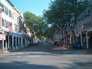
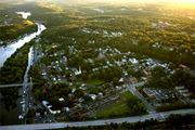
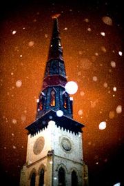
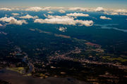
Kingston has at least three distinct neighborhoods. The uptown area, the Stockade District, was the first capital of New York State. The downtown area, once the village of Rondout, now the Rondout-West Strand Historic District, borders the Rondout Creek. The creek empties into the Hudson through a large, protected tidal area which was the terminus of the Delaware and Hudson Canal, built to haul coal from Pennsylvania to New York City.[7]
Downtown, called "the Rondout" because it was formerly Rondout, New York, is an artist community labeled by Business Week online as one of "America's best places for artists."[8] It is home to a large number of art galleries.
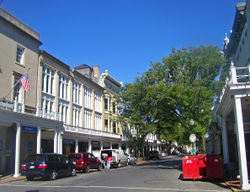
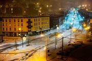
While the Uptown area is noted for its "antique" feeling, the overhangs attached to buildings along Wall and North Front streets were added to historic buildings in the late 1970s and are not authentically part of the 19th century Victorian architecture. A controversy is currently unfolding over whether to restore or remove the overhangs, locally known as the Pike Plan. More notably in Uptown is the Stockade district, where many 17th century stone buildings remain. Most notable of these is the Senate House, which was built in the 1670s and was used as the state capital during the revolution. Many of these old buildings were burned by the British in 1777 and restored later.
Kingston holds many festivals in the Rondout neighborhood, including the Kingston Jazz Festival and the Artists Soapbox Derby. Meanwhile the uptown historic district celebrates and re-creates the Burning of the town by the British every other year, without actually damaging any of its historic buildings.
The city is noted for its many restaurants, some run by graduates of the nearby Culinary Institute of America.
According to the United States Census Bureau, the city has a total area of 8.6 square miles (22.4 km2), of which 7.3 square miles (19.0 km2) is land and 1.3 square miles (3.4 km2), or 15.03%, is water.
The city is on the west bank of the Hudson River. Neighboring towns include Hurley, Saugerties, Rhinebeck, and Red Hook.

Demographics
As of the census[9] of 2000, there were 23,456 people, 9,871 households, and 5,498 families residing in the city. The population density was 3,189.5 persons per square mile (1,232.2/km2). There were 10,637 housing units at an average density of 1,446.4 houses per square mile (558.8/km2). The racial makeup of the city was 80.38% White, 12.77% Black or African American, 0.30% Native American, 1.53% Asian, 1.90% from other races, and 3.12% from two or more races. Hispanic or Latino of any race were 6.46% of the population.
There were 9,871 households out of which 27.0% had children under the age of 18 living with them, 35.2% were married couples living together, 15.8% had a female householder with no husband present, and 44.3% were non-families. 36.8% of all households were made up of individuals and 14.8% had someone living alone who was 65 years of age or older. The average household size was 2.28 and the average family size was 3.02.
In the city the population was spread out with 23.9% under the age of 18, 8.1% from 18 to 24, 28.9% from 25 to 44, 21.9% from 45 to 64, and 17.1% who were 65 years of age or older. The median age was 38 years. For every 100 females there were 89.1 males. For every 100 females age 18 and over, there were 84.1 males.
The median income for a household in the city was $31,594, and the median income for a family was $41,806. Males had a median income of $31,634 versus $25,364 for females. The per capita income for the city was $18,662, with 12.4% of families and 15.8% of the population below the poverty line, including 23.5% of those under age 18 and 10.3% of those age 65 or over.
Government
The government of Kingston consists of a mayor and city council known as the Common Council. The Common Council consists of 10 members, nine of which are elected from wards while one is elected at large. The mayor is elected in a citywide vote.
Transportation
Commuter service is available by bus to New York City daily. Passenger railroad service to Kingston itself has been discontinued for several decades. However, about 10 miles (20 km) away is the Rhinecliff-Kingston Amtrak station. CSX Transportation operates freight rail service through Kingston on the River Line Subdivision. There is also a small rail yard of about 7 tracks in Kingston.
New York State Route 199 has the nearest bridge traversing the Hudson River, 5.48 miles (8.82 km) to the north. U.S. Highway 9W runs north-south through the city. The New York State Thruway, also known at this section as Interstate 87, runs through the western part of the city.
The area is served by Kingston-Ulster airport (2ON), located at the western base of the Kingston-Rhinecliff bridge. The nearest major airports to Kingston are Stewart International Airport about 38 miles (40 km) south in Newburgh, and Albany International Airport approximately 65 miles (121 km) north.[10] The three major metropolitan airports for New York City - John F. Kennedy International approximately 109 miles (142 km) south, Newark Liberty International approximately 104 miles (169 km) south, and LaGuardia Airport approximately 98 miles (129 km) south.
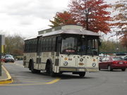
City bus service is provided by the city-owned CitiBus system, while service to points elsewhere in Ulster County is provided by Ulster County Area Transit (UCAT).
On the first Saturday of every month an “art bus” is available for a fare of $1. The bus, usually a CitiBus tourist trolley, takes passengers on a guided tour of the art galleries of Kingston. Kingston's art galleries all have openings on the first Saturday of the month.
Kingston historically was an important transportation center for the region. The Hudson River, Rondout Creek and Delaware and Hudson Canal were important commercial waterways. At one time, Kingston was served by four railroad companies and two trolley lines. Kingston was designated as a New York State Heritage Area with a transportation theme and the Hudson River Maritime Museum and Trolley Museum of New York are located on the waterfront.
Sports
Kingston is home to the Hudson Valley Highlanders of the North American Football League. They play their home games at Dietz Stadium.
The Hudson Valley Renegades are a minor league baseball team affiliated with the Tampa Bay Rays. The team is a member of the New York - Penn League, and play at Dutchess Stadium in nearby Fishkill.
The Hudson Valley Bears are one of four founding members of the Eastern Professional Hockey League (EPHL). They play their home games at the Mid-Hudson Civic Center in nearby Poughkeepsie.
The Hudson Valley Hawks is a team in the newly formed National Professional Basketball League. The team's home court is at Beacon High School, in nearby Beacon.
The Kingston Tigers are the city high school's mascot. The John A. Coleman Catholic Statesman play in nearby Town of Ulster.
Education
- Kingston High School (Kingston, New York) is the city's public high school
- Most students at John A. Coleman Catholic High School reside within the Kingston city school district.
Media
- Newspapers
- Kingston-based: Daily Freeman, Kingston Times, Ulster County Press
- Outside Kingston:* ART TIMES, Poughkeepsie Journal, Times-Herald Record, (Middletown)
- Television: Time Warner Cable Kingston Area Public Access Channel 23
- Radio
- Kingston-based: WGHQ (920 AM), WKNY (1490 AM), WKXP (94.3 FM)
- Outside Kingston: WFGB (89.7 FM), WBPM (92.9 FM, Saugerties), WKZE-FM (98.1, Salisbury CT/Rhinebeck), WDST (100.1 FM, Woodstock).
- Magazines: The Kingston-based Chronogram publishes a thick, glossy, colorful magazine dedicated to the art, culture and spirit of the Hudson Valley.
Health and medical
- Kingston Hospital
- Benedictine Hospital
People, past and present
Actors, musicians and others in the entertainment industry
- Peter Bogdanovich (b. 1939) a film director, writer and actor, was born in town.
- Robert Craft (b. 1923), an award-winning conductor who has led many of the major orchestras in the United States, and a collaborator with Igor Stravinsky, was born in the city.
- Adam Snyder (b. 1966), musician, resident, former member of Mercury Rev released 2007 album "Thi Town Will Get Its Due"
- Joseph Kesselring (1902–1967), a writer and playwright best known for his play Arsenic and Old Lace, died in the city.
- Elissa Landi (1904–1948), an Italian born actress was popular in Hollywood films of the 1920s and 1930s, died of cancer in the city.
- Trudy Wiggins (1935–2006), an actress best known for roles in television daytime drama, later produced and appeared in her own talk show on WTZA-TV in the city.
- Josh Eppard (b. 1979) original drummer for rock band 3, original drummer for rock band Coheed and Cambria, hip hop artist Weerd Science and musical composer born in Kingston, NY.
- Michael Todd (b. 1980) bassist for progressive rock band Coheed and Cambria.
- Paul Austin Kelly (b. 1960) Opera tenor, jazz singer, children's music performer and impresario
- Pauline Oliveros, composer and musician
- Danny Taylor, drummer for pioneering electronic duo Silver Apples lived in Kingston until his death in 2005.
- Larry Grenadier (b. 1966), Jazz bassist. Originally from San Francisco, CA. Moved to Kingston in 2002.
- Rebecca Martin (b. 1969), Singer-songwriter and community activist. Started garden movement in the city of Kingston in 2007. Originally from the State of Maine, and resident of Kingston since 2002.
- Guy James Walker, Most recently worked with Marty Balin of Jefferson Airplane / Starship doing record with Balin in Jan. 2010. Earned a Platinum record for his work on Backstreet Boys, Black and Blue Record. Producer, songwriter, arranger, guitarist with Backstreet Boys 1999-2000.
- Paul Kreppel (b. 1947) Television and Broadway theatre director and actor born in the city.
Politics, political activism, government service
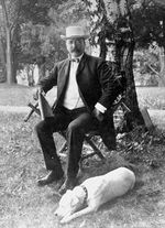
- George Clinton (1739–1812), fourth vice president of the United States and first elected governor of New York State, is buried in the city at the Old Dutch Church.
- Charles DeWitt (1727–1787), a miller and statesman from Kingston, served as a delegate to the Continental Congress.
- Abraham Bruyn Hasbrouck (1791–1879), a U.S. Congressman and the sixth President of Rutgers College (now Rutgers University), was born and died in the city.
- Alton B. Parker (1852–1926), Democratic presidential nominee in 1904, practiced law in the city and was the first president of the Ulster County Bar Association. He not only lost the election, he didn't even carry Ulster County.
- Sojourner Truth (c. 1797–1883), former slave and early abolitionist, tried to gain her freedom in Ulster County Court in the city.
- John Van Buren (1799–1855), US Congressman
- KingstonCitizens.org - a citizen organized effort created to build community and to connect citizens to their elected alderman through education, local issues, and projects.
- The Kingston Land Trust - dedicated to preserving open space in the city of Kingston and home of the Kingston Victory Garden movement.
Others
- Heywood Hale Broun (1918–2001) a sportswriter and commentator, died in the city.
- Robert H. Dietz (1921–1945), United States Army soldier and Medal of Honor recipient in World War II
- Ezra Fitch (1866–1930), the "Fitch" in "Abercrombie & Fitch, practiced law in Kingston before leaving to join Abercrombie in his wilderness outfitting store in New York City in 1900. He bought out Abercrombie in 1907.
- Charles Freer (1854–1919), who donated his art collection to the Smithsonian Institution, was born in Kingston. The Freer Gallery of Art, part of the Smithsonian, was named after him.
- Walter B. Gibson (1987-1985), American author and professional magician, most famous for his pulp fiction character, The Shadow.
- Brian Kenny (b. 1963), a journalist who anchors Friday Night Fights and ESPNEWS' The Hot List, previously worked for WTZA in the city.
- Evaline Ness (1911–1986) an illustrator and author who won a Caldecott Medal in 1967 for Sam, Bangs, and Moonshine, and who was married to Untouchable Eliot Ness from 1938–1946, died in the city.
- Maud Petersham (1890–1971), who won the Caldecott Medal with her husband and coauthor, Miska Petrezselyem Mikaly, in 1946 for "The Rooster Crows", was born in Kingston.
- Andrée Ruellan (1905–2006), a painter whose works are in the permanent collections of the Metropolitan Museum of Art and the Whitney Museum, died in the city.
- Anne Sweeney (b. 1957), Co-Chair of Disney Media Networks and President of the Disney-ABC Television Group, who has been named the "Most Powerful Woman in Entertainment" by The Hollywood Reporter, and one of the "50 Most Powerful Women in Business" by Fortune magazine and one of "The World's 100 Most Powerful Women" by Forbes, spent her childhood in Kingston and is a graduate of Kingston's Coleman High School.
- Mike Ferraro (b. 1944), a third baseman for the New York Yankees and Milwaukee Brewers, and later coach for the Kansas City Royals, was born in the city.
- Jervis McEntee (1828–1891), a painter of the Hudson River School, is buried in Montrepose Cemetery in the city.[11]
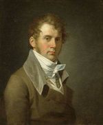
- John Vanderlyn (1776–1852), a neoclassicist painter, was born in the city.
- Calvert Vaux (1824–1895), a noted architect and landscape designer; co-designer of Central Park, NYC; buried in Kingston's Montrepose Cemetery.
- Dave Ferraro (6/8/1959[12]-), resident of the city, was a professional bowler and was inducted into the PBA Hall of Fame in 1997.
- Ron Suskind, journalist and writer (b. 1959)
- Paul Runge Jr., (b. 1958), infielder for the Atlanta Braves during the 1980s and manager of several minor league teams was born and grew up in Kingston. Half brother of major leaguer Joe Ausanio.
- Joe Ausanio, (b. 1965), pitcher for the New York Yankees during the 1990s was born and grew up in Kingston. Half brother of major leaguer Paul Runge.
Notes
- ↑ Brungard, Bond. "Ponck Hockie was a landing point for British troops". Poughkeepsie Journal. http://cityguide.pojonews.com/fe/Heritage/stories/he_ponck_hockie.asp. Retrieved 2007-10-10.
- ↑ "Kingston". National Park Service. http://www.nps.gov/nr/travel/kingston/transport.htm. Retrieved 2008-09-19.
- ↑ "Close Of The Ice Harvest.; Nearly All The Houses Filled--The Largest Crop Ever Gathered". The New York Times. 1881-01-25. http://query.nytimes.com/gst/abstract.html?res=9C0CE6DB1F3AE533A25756C2A9679C94609FD7CF. Retrieved 2010-05-07.
- ↑ http://brickcollecting.com/shultz.htm
- ↑ http://www.hudsonvalleyruins.org/yasinsac/ulster/ekingston.html
- ↑ "US Gazetteer files: 2000 and 1990". United States Census Bureau. 2005-05-03. http://www.census.gov/geo/www/gazetteer/gazette.html. Retrieved 2008-01-31.
- ↑ "Hudson River Maritime Museum". http://www.hrmm.org/rondout/rondout.htm.
- ↑ "America's Best Places for Artists". BusinessWeek. http://images.businessweek.com/ss/07/02/0226_artists/index_01.htm. Retrieved 2007-10-10.
- ↑ "American FactFinder". United States Census Bureau. http://factfinder.census.gov. Retrieved 2008-01-31.
- ↑ "Traveler's Information". Ulster County. http://www.ulstertourism.info/travlersinfo.html#transport.
- ↑ "Monterose Cemetery at Find-a-Grave". Find-a-grave. http://www.findagrave.com/cgi-bin/fg.cgi?page=gr&GSln=mcentee&GSfn=jervis&GSiman=1&GScid=65295&GRid=5660059&. Retrieved 2010-06-07.
- ↑ http://pba.com/players/hof/playerbio.asp?ID=240
External links
- City of Kingston, New York
- City Data with Charts
- Kingston: Discover 300 Years of New York History, a National Park Service Discover Our Shared Heritage Travel Itinerary
|
||||||||||||||||||||||||||
|
|||||||||||||||||
